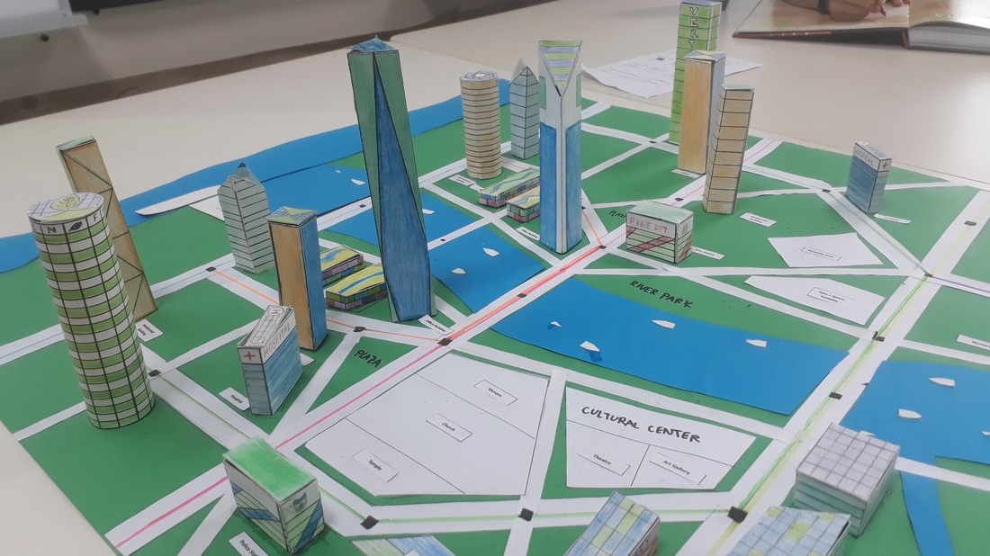
Welcome to the G.R.E.E.N. City! That is, the Grimia Residential Economic Environmental National City. For our last project in Geography, we were tasked, in groups of 4–5, to create a Sustainable City that integrates eight aspects, Food Systems, Water Consumption, Energy Consumption, Waste Management Systems, Transportation Systems, Green Architecture, Ecosystem Use, and Employment and Services.
|
Project Brief:
The inhabitants of the small country of ‘Grimia’ are concerned by their country’s high pollution levels. In attempts to create a less grimy future, a Government Urban and Environmental planning (UEP) Committee has been commissioned to build the world’s foremost sustainable eco-community. The committee is looking for a team of urban and environmental planners to lead their city design and construction efforts. |
The list of urban specifications we had to consider:
- The city is in a tropical climate.
- The city will be located at the mouth of a large river, on the ocean.
- The land is currently undeveloped. There are mangrove forests along the coast. The land is tropical forest.
- You are not near a tectonic plate boundary.
- The city will be home to approximately 10,000 people. It needs to have room for these people and all necessary amenities.
- ‘Grimia’ is an HIC.
- Up to 100 km2 available
The topics that I chose to focus on and cover for the city were Green Architecture and Transportation Systems.
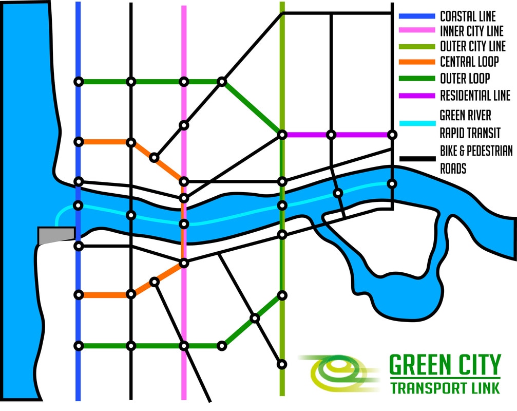
Transportation Systems
The G.R.E.E.N. City uses an Integrated Transport System that links all modes of transport within the city. These include Trams, Boats (Both of which are powered by electricity), Bicycles, and Pedestrian Walkways. I chose to design the city around efficient and effective public transportation. All modes of transport are linked with an app to maximise efficiency for a hassle free commute. The system is called the Green City Transport Link.
|
The City's layout is designed around transport, with an extensive road system. 2 Circumferential Roads designed to bring people around the city, and 10 Radial Roads designed to bring people in and out of the city. Both Circumferential Roads, as well as 4 Radial Roads include Metro Tram Lines for Rapid Transit. In the middle of the city lies the Green River, which has a Boat Rapid Transit System that acts as a main artery for bringing people in and out of the city. The other remaining roads are Pedestrian and Bike Highways.
|
This transportation system has many benefits. The electric public transportation vehicles allow for the use of renewable energy. The transportation is also a quicker, easier, and cheaper mode of transportation, as trams and boats used are much cheaper than subways or elevated trains. By using the river for a Boat Rapid Transit System, the city utilises natural geography without destroying more land and rainforests for the construction of roads. However, there are also negatives to this design. There is less personal freedom of travel in terms of the transportation system, that is achieved by cars. Breakdowns or malfunctions in the integrated transport system can cause inconveniences, delay travel, and may affect the productivity of the city and bring it to a stop.
The city is also aimed towards Pedestrianisation and Bikeability. All roads in the city have Bike and Pedestrian lanes, and designated roads are for Bikes and Pedestrians only, encouraging a lower carbon footprint.
